


2018 School Spending Survey Report
Geography and maps
Brasch, Nicolas Community Maps
Gr.
 Brasch, Nicolas Community Maps
Gr. 4–6 32 pp. Smart Apple
Brasch, Nicolas Country Maps
Gr. 4–6 32 pp. Smart Apple
Brasch, Nicolas Land and Sea Maps
Gr. 4–6 32 pp. Smart Apple
Brasch, Nicolas World Maps
Gr. 4–6 32 pp. Smart Apple
Map Smart series. This series looks at how maps are created, special features (e.g., grid, scale, colors) and symbols, and how to read maps. What makes a good map and new mapping technology are explored, as well as older ways of mapping. Much of the information is repeated among the volumes. Each busily designed book includes a map-making activity and an "Are You 'Map Smart'?" quiz. Glos., ind.
Subjects: Geography and Exploration; Maps; Oceans
 Cane, Ella Countries in My World
Gr. K–3 24 pp. Capstone
Cane, Ella Neighborhoods in My World
Gr. K–3 24 pp. Capstone
Cane, Ella States in My World
Gr. K–3 24 pp. Capstone
Pebble Books: My World series. These formulaic first nonfiction books provide new readers with information about each geographic division's characteristics, similarities and differences among regions, and examples of natural features (e.g., mountains). Each double-page spread features two sentences on the right and a full-page stock photo or map on the left. These are accessible if very basic introductions. Reading list. Glos., ind.
Subjects: Geography and Exploration; Neighborhoods; United States
 Kralovansky, Susan What Would You Do with an Atlas?
Gr. K–3 32 pp. ABDO
Super SandCastle: Library Resources series. Staged photographs of young, enthusiastic "researchers" welcome primary-grade readers on a quick tour of atlases. Simple, easy-to-read text, sidebars, and labeled photos provide a brief introduction to atlases and the range of features they highlight . This overview is clearly organized, and the presentation is inviting. Glos.
Subjects: Geography and Exploration; Maps
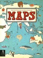 Mizielinska, Aleksandra Maps
Gr. 4–6 110 pp. Candlewick/Big Picture
Illustrated by Daniel Mizielinski. Each map in this attractive book reveals an engaging mix of tourist sites, animals, traditionally dressed people, important figures such as Gandhi and Homer, products and cultural items (e.g., Japanese manga, Russian nesting dolls), as well as facts and figures. With a retro look reminiscent of old illustrated atlases, this browsable volume will lead to wanderlust.
Subjects: Geography and Exploration; Maps
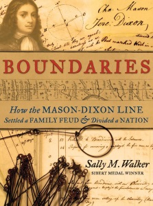 Walker, Sally M. Boundaries: How the Mason-Dixon Line Settled a Family Feud & Divided a Nation
High school 202 pp. Candlewick
The exact location of the boundary between the colonies of Maryland and Pennsylvania was in dispute until Charles Mason and Jeremiah Dixon were hired in 1763 to solve the problem once and for all. Walker delves deeply into her topic, providing meticulous detail not only about surveying but also about colonial-era socio-politics. Numerous maps, diagrams, and illustrations are interspersed throughout the narrative. Websites. Bib., ind.
Subjects: North America; Southern States; Mason, Charles; Dixon, Jeremiah; History, American—Colonial life; Geography; Maryland; Pennsylvania; Maps
From the November 2014 issue of Nonfiction Notes from the Horn Book.

Added To Cart
RELATED


RECOMMENDED
Please register with us to continue reading.
ALREADY A SUBSCRIBER? LOG IN
We are currently offering this content for free. Sign up now to activate your personal profile, where you can save articles for future viewing.
ALREADY A SUBSCRIBER? LOG IN
Thank you for visiting.
We’ve noticed you are using a private browser. To continue, please log in or create an account.

Add Comment :-
Be the first reader to comment.
Comment Policy:
Comment should not be empty !!!